Sea Level Rise
Additional Resources
The charter of the Sippewissett Association states that one of its purposes is to protect and prevent the misuse of public and common areas in the Sippewissett region. An integral part of the shared common areas is the water surrounding our area. Buzzards Bay borders the entire western edge, Sippewissett Marsh is at the northern end of our area, and Quissett Harbor lies at our southern boundary. In addition there are many ponds and vernal pools that are vital to the wildlife and to residents’ enjoyment in the area. Clearly, water quality and sea level rise are immediate issues in our Sippewissett region. The Sippewissett Association seeks to protect our water quality and monitor sea level rise both through its members' involvement in protecting these resources and the Association’s financial support of local and regional organizations who protect our valued resources.
Currently, our Board monitors and regularly reports on four organizations and state programs addressing sea level rise.
Woods Hole is home to world-renowned scientific organizations, a vibrant business and residential community, and serves as a vital ferry link to the island of Martha’s Vineyard. With a mission-focused need to be proximate to the sea, the Woods Hole Oceanographic Institution (WHOI), the Marine Biological Laboratory (MBL), and NOAA’s Northeast Fisheries Science Center (NOAA) initiated the development of a long-range framework to prepare for sea-level rise and increasing extreme weather events. A cooperative effort is underway to assess these threats and jointly develop solutions that frame responses for the broader Woods Hole community. Thus, the Resilient Woods Hole initiative was born. Various groups contribute to this effort, including scientific organizations, community members, the business community, and state and regional officials.
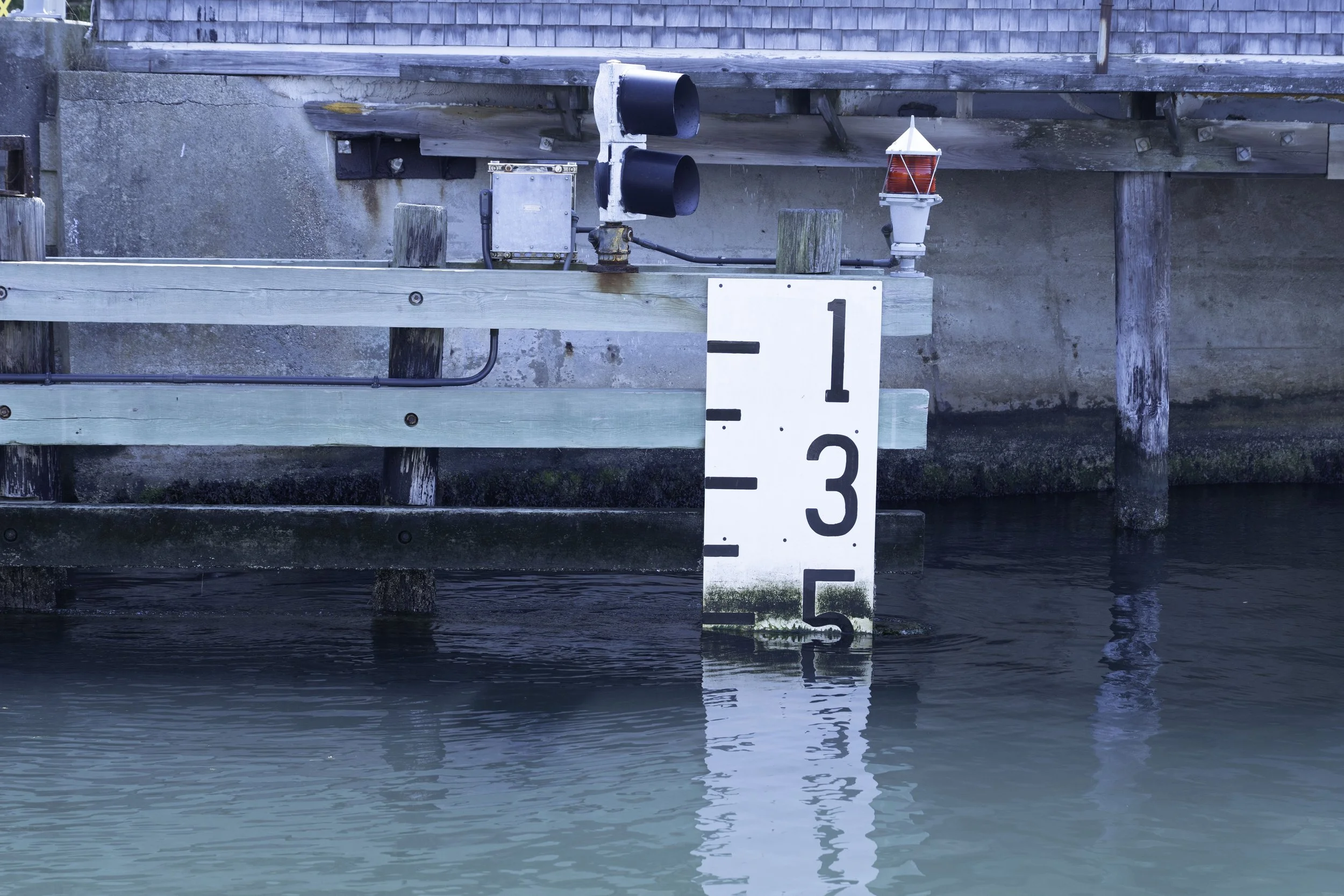
2. Quissett Harbor Tide Gauge Monitor
This was installed in 2023 to give real-time data on tide levels in Sippewissett. It is mounted on a private dock in Quissett Harbor. Through the TideCast app, available through the Hohonu platform, real time tide readings are available. Further information can be found here.
3. Massachusetts Office of Coastal Zone Management
Information is available on the MyCoast online portal, https://mycoast.org/ma, an online portal developed for the Massachusetts Office of Coastal Zone Management (CZM) that allows the public to collect and share photos and observations online or using a mobile app.
Reports submitted to MyCoast of extreme high tides, coastal storm impacts, and living shoreline projects help increase awareness of flooding, erosion, and other coastal hazards and help inform storm response and coastal management decisions. MyCoast:
Massachusetts includes the tools below for collecting, sharing, and viewing photos and other information.
King Tides - The Massachusetts king tides initiative documents the effects of extreme high tides during new and full moons. The public is encouraged to submit photos, which are used in the analysis of coastal vulnerability and planning initiatives with municipalities.
StormReporter - This tool is used to record photos and observations of flooding, erosion, and damages to buildings and infrastructure. The public can also add photos of coastal storm damage in their communities.
Coastal Resilience - This tool helps monitor living shorelines, which are nature-based approaches for shoreline management.
4. The Association to Preserve Cape Cod
Covering broader, but closely related issues described above, the Association to Preserve Cape Cod (APCC) is dedicated to the protection, preservation, and restoration of the natural resources of Cape Cod. APCC understands how local, regional, state, and federal government policies affect the environment. APCC is Cape Cod’s ever-vigilant caretaker, in the field as well as in the halls of government at the local, state, and federal levels. It educates, trains citizen scientists in environmental monitoring, helps the public connect with and understand the Cape’s ecology, and organizes volunteer initiatives such as the Cape’s springtime herring counting program.